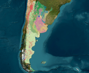
Annual land cover and land use map collections in Argentina:

Collection 1 - published in May 2024 with a legend of 15 classes covering the period 1998-2022

ATTENTION: MapBiomas Argentina maps are products of evolution. Make sure you always use the latest version available. It is recommended to use MapBiomas Argentina maps up to a scale of 1:100,000. Although it is possible to view them at a larger scale (1:50,000), we do not recommend using them at this scale. Data describing landscape dynamics for the country are constantly developing. For more information on the methodology, visit the ATBD.

MAPS

Land Cover and Land Use Maps

Maps in raster format, pixel size of 30x30m. The legend of these maps and the covered period evolve throughout the MapBiomas collections. It can be accessed in the Platform or in the section: Downloads/Collection Maps.

METHODOLOGY

Landsat Mosaics 

Image mosaics for each year of the historical series, with a resolution of 30 m formed by the composition of representative pixels from each set of images of a local datum, over a certain period of time. It can be accessed in the section: Downloads/ Landsat Mosaics.

Methodological Notes - ATBD

Methodological notes produced in ATBD format that explain the working method including specifications for each region. 

Collections of Scripts on GitHub

Collections of scripts at https://github.com/mapbiomas-argentina that allow for multiplication and adaptation to other contexts.

PUBLICATIONS

Highlighted Information

Highlighted information from Collection 1 of MapBiomas Argentina that could be accessed in the Download/Highlights Section.